MAKE A MEME
View Large Image

| View Original: | 1861_Johnson_and_Browning_Map_of_Australia_(First_Edition)_-_Geographicus_-_Australia-johnson-1861.jpg (4000x3319) | |||
| Download: | Original | Medium | Small | Thumb |
| Courtesy of: | commons.wikimedia.org | More Like This | ||
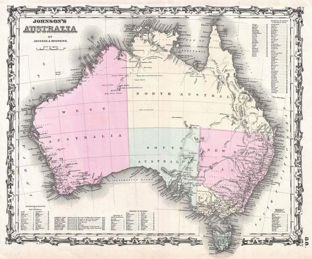
| Keywords: 1861 Johnson and Browning Map of Australia (First Edition) - Geographicus - Australia-johnson-1861.jpg A beautiful first edition example of A J Johnson ôs 1861 map of Australia This is the first edition and earliest state in the Johnson Australia series Depicts the continent with good detail along the coast and a largely unexplored interior Shows the Torrens Basin the Stony Desert Traveler's Valley and the extant of Sturt's inland exploration Tables in the corners show references to various counties in each provinces A smaller table in the lower left provides a time line for the exploration of the continent noting the dates associated with important navigators including Tasman Arnhem Hartog Edel Flinders and others Features the strapwork style border common to Johnson ôs atlas work from 1860 to 1863 Published by A J Johnson and Browning as plate number 88 in the 1861 edition of Johnson ôs New Illustrated Family Atlas Though Johnson did print an 1860 edition of his atlas it did not contain a specific Australia map This is the last edition of the Family Atlas to bear the Johnson and Browning imprint 1861 undated Size in 15 5 13 5 object history credit line accession number s Geographical Statistical and Historical </i> 1861 A J Johnson and Browning edition Geographicus-source PD-old-100 Maps by Alvin Jewett Johnson 1861 maps Old maps of Australia | ||||