MAKE A MEME
View Large Image

| View Original: | 1843_Tienpo_14_Edo_Period_Map_of_Mt._Fuji,_Tokyo,_and_Vicinity_-_Geographicus_-_Fuji-edo-1843.jpg (7000x6145) | |||
| Download: | Original | Medium | Small | Thumb |
| Courtesy of: | commons.wikimedia.org | More Like This | ||
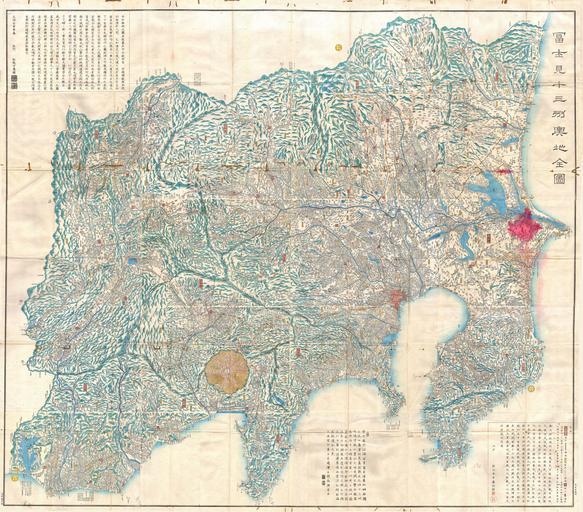
| Keywords: 1843 Tienpo 14 Edo Period Map of Mt. Fuji, Tokyo, and Vicinity - Geographicus - Fuji-edo-1843.jpg Artwork This extraordinary item is a hand colored Edo Period woodcut map of Edo or Tokyo Mt Fuji and the vicinity Japan Staggering size and detail Covers the 13 states surrounding Mt Fuji Dated Tienpo 14 of Edo Period or 1843 Produced in the mid 19th century Japanese woodcut style this map is a rare combination of practical and decorative Beautifully rendered in woodcut with hand coloring - no specific directional orientation All text is in Japanese and seems to be oriented to the center of the map A fine example from the golden period of Japanese cartography and an extraordinarily rare piece A must for any serious collection of Japanese cartography 1843 Size in 61 62 object history credit line accession number Fuji-edo-1843 Geographicus-source PD-art Old maps of Japan Maps of Mount Fuji Maps in Japanese 1843 maps | ||||