MAKE A MEME
View Large Image

| View Original: | 1822_-_William_Home_Lizars_-_Comparative_View_of_the_Lengths_of_the_Principal_Rivers_of_Scotland.jpg (8743x6378) | |||
| Download: | Original | Medium | Small | Thumb |
| Courtesy of: | commons.wikimedia.org | More Like This | ||
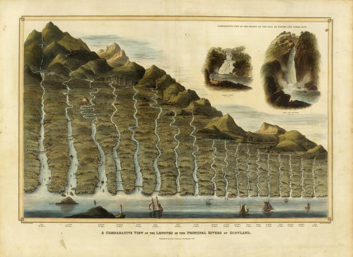
| Keywords: 1822 - William Home Lizars - Comparative View of the Lengths of the Principal Rivers of Scotland.jpg LargeImage Artwork en Comparison chart of the principal rivers of Scotland; published in the Atlas of Scotland published by John Thomson Edinburgh 1822 Size cm 12 5 9 5 object history credit line accession number http //www davidrumsey com/luna/servlet/detail/RUMSEY~8~1~35301~1180926 PD-old-auto 1859 PD-old-100 Uploaded with UploadWizard Geographic comparison diagrams River-related diagrams Old maps of Scotland ImageNote 1 929 5537 219 131 8743 6378 2 Tay 110 Miles ImageNoteEnd 1 ImageNote 2 1596 5548 251 131 8743 6378 2 Clyde 100 Miles ImageNoteEnd 2 ImageNote 3 2415 5548 219 131 8743 6378 2 Forth 90 Miles ImageNoteEnd 3 ImageNote 4 2863 5537 230 142 8743 6378 2 Tweed 85 Miles ImageNoteEnd 4 ImageNote 5 3333 5548 219 120 8743 6378 2 Spey 85 Miles ImageNoteEnd 5 ImageNote 6 3770 5548 208 131 8743 6378 2 Dee 80 Miles ImageNoteEnd 6 ImageNote 7 4317 5548 219 131 8743 6378 2 Don 60 Miles ImageNoteEnd 7 ImageNote 8 4754 5548 230 120 8743 6378 2 Nith 60 Miles ImageNoteEnd 8 ImageNote 9 5224 5548 230 131 8743 6378 2 Annan 40 Miles ImageNoteEnd 9 ImageNote 10 5508 5548 230 131 8743 6378 2 S Esk 40 Miles ImageNoteEnd 10 ImageNote 11 5792 5548 208 120 8743 6378 2 Teviot 35 Miles ImageNoteEnd 11 ImageNote 12 6076 5548 197 109 8743 6378 2 Isla 35 Miles ImageNoteEnd 12 ImageNote 13 6306 5548 208 120 8743 6378 2 Earn 35 Miles ImageNoteEnd 13 ImageNote 14 6568 5537 208 120 8743 6378 2 N Esk 30 Miles ImageNoteEnd 14 ImageNote 15 6852 5537 219 120 8743 6378 2 Esk 30 Miles ImageNoteEnd 15 ImageNote 16 7115 5537 186 109 8743 6378 2 Teith 30 Miles ImageNoteEnd 16 ImageNote 17 7366 5537 219 109 8743 6378 2 Garry 25 Miles ImageNoteEnd 17 ImageNote 18 7727 5548 175 109 8743 6378 2 Ayr 25 Miles ImageNoteEnd 18 | ||||