MAKE A MEME
View Large Image

| View Original: | 1814_Thomson_Map_of_Australia,_New_Zealand_and_New_Guinea_-_Geographicus_-_Australia-thomson-1814.jpg (5000x4040) | |||
| Download: | Original | Medium | Small | Thumb |
| Courtesy of: | commons.wikimedia.org | More Like This | ||
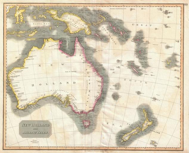
| Keywords: 1814 Thomson Map of Australia, New Zealand and New Guinea - Geographicus - Australia-thomson-1814.jpg This a wonderful example of John Thompson ™s 1814 Map of Australia New Zealand New Guinea and parts of Polynesia Extends from Western Australia and the Celebes eastward as far as New Caledonia and the Fiji Islands Extends southward as far as New Zealand and Chatham Island Notes the discoveries of important explorers in the region including Captain Grant Captain Bandin Captain Cook Captain Flinders Captain Bass Captain Dampier and others Make notes on terrain soil water sources and safe ports This map was prepared around the same time that Captain Flinders published the first accurate map of the Australian coast Slightly crisper impression in the south eastern portions of Australia suggests several updates based upon Flinders ™ work Prepared in 1814 by John Thomson for publication by Baldwin Cradock as plate no 73 in the 1817 edition of Thomson ™s New General Atlas 1814 dated Size in 25 20 object history credit line accession number Australia-thomson-1814 Thomson John <i>A new general atlas consisting of a series of geographical designs on various projections exhibiting the form and component parts of the globe; and a collection of maps and charts delineating the natural and political divisions of the empires kingdoms and states in the World Constructed from the best systematic works and the most authentic voyages and travels With a memoir of the progress of geography a summary of physical geography and a consulting index to facilitate the finding out of places Edinburgh Printed by George Ramsay and Company for John Thomson and Company Edinburgh; Baldwin Cradock and Joy London; and John Cumming Dublin 1817 </i> 1817 edition Geographicus-source PD-old-100 Maps by John Thomson 1814 maps Old maps of Australia Old maps of New Zealand Old maps of New Guinea Old maps showing history of Oceania Maps in English | ||||