MAKE A MEME
View Large Image

| View Original: | 1811_Pinkerton_Map_of_Persia_(_Iraq,_Iran,_Afghanistan)_-_Geographicus_-_Persia-pinkerton-1811.jpg (6000x4383) | |||
| Download: | Original | Medium | Small | Thumb |
| Courtesy of: | commons.wikimedia.org | More Like This | ||
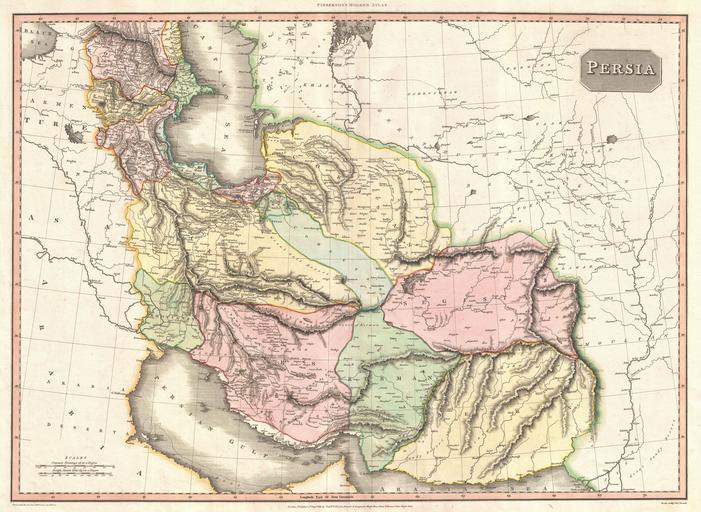
| Keywords: 1811 Pinkerton Map of Persia ( Iraq, Iran, Afghanistan) - Geographicus - Persia-pinkerton-1811.jpg An exceptionally attractive example of John Pinkerton's rare 1811 map of Persia Covers from the Black Sea in the northwest to Fergana in the northeast to the Arabian Desert in the southwest to the Mouths of the Indus in the southeast Roughly includes the modern day nations of Iraq Iran Afghanistan and Pakistan We cannot praise Pinkerton's cartographic work sufficiently This masterful map offers extraordinary detail fine engraving and delicate color work Pinkerton emerged as one of the preeminent cartographers of a important transitional period wherein the decorative elements common to 17th and 18th century cartography were being discarded in exchange for accuracy and detail This map is no exception Pinkerton details mountains deserts swamps lakes and river systems He shows offshore reefs and banks in the Persian Gulf and the Arabian Sea He also notes numerous towns villages and even castles Lake Van in what is today eastern Turkey ancient Armenia Pinkerton labels doubtful though it does in fact exist Near Van we can also find Mt Ararat and the ruins of several ancient cities Further south Pinkerton notes the Ruins of Babylon Bagdad and Bossra Altogether a fine and extraordinary map Drawn under the direction of John Pinkerton by L Herbert for issue as plate no 35 in the 1815 Cadell Davies issue of Pinkerton's Modern Atlas Dated September 1st 1811 1811 dated Size in 28 21 object history credit line accession number Persia-pinkerton-1811 Pinkerton J <i>Pinkerton's Modern Atlas</i> 1815 Geographicus-source PD-old-100 Maps by John Pinkerton Old maps of Iran 1811 maps Maps in English | ||||