MAKE A MEME
View Large Image
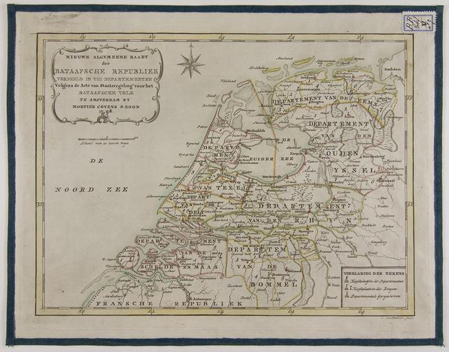
| View Original: | 1798,_Map_of_the_Batavian_Republic_of_the_Netherlands.jpg (3000x2354) | |||
| Download: | Original | Medium | Small | Thumb |
| Courtesy of: | commons.wikimedia.org | More Like This | ||
| Keywords: 1798, Map of the Batavian Republic of the Netherlands.jpg nl Nieuwe algemeene kaart der Bataafsche Republiek verdeeld in VIII departementen volgens de Acte van staatsregeling voor het Bataafsche volk ± 1 1 340 000 22 x 29 5 cm Handgekleurd geplakt op linnen en New general map of the Batavian Republic divided into VIII departments according to the Deed of Constitution of the Batavian people ± 1 1 340 000 Hand Colored pasted on canvas de Neue à bersichtskarte des Batavische Republik in VIII Bezirke nach der Akte von Verfassung der Bataver Volk aufgeteilt ± 1 1 340 000 Handcoloriert auf Leinwand geklebt fr Nouvelle carte générale de la République batave divisée en VIII départements selon l'Acte de la Constitution du peuple batave ± 1 1 340 000 Colorisée collé sur toile 1798 http //irs ub rug nl/ppn/108730980 Universiteitsbibliotheek Rijksuniversiteit Groningen Cornelis van Baarsel 1761-1826 other versions Custom license marker 2015 02 05 PD-old-auto 1826 Uploaded with UploadWizard Old maps of the Batavian Republic | ||||