MAKE A MEME
View Large Image

| View Original: | 1780_Raynal_and_Bonne_Map_of_Southern_Brazil,_Northern_Argentina,_Uruguay_and_Paraguay_-_Geographicus_-_Bresil-bonne-1780.jpg (2500x1680) | |||
| Download: | Original | Medium | Small | Thumb |
| Courtesy of: | commons.wikimedia.org | More Like This | ||
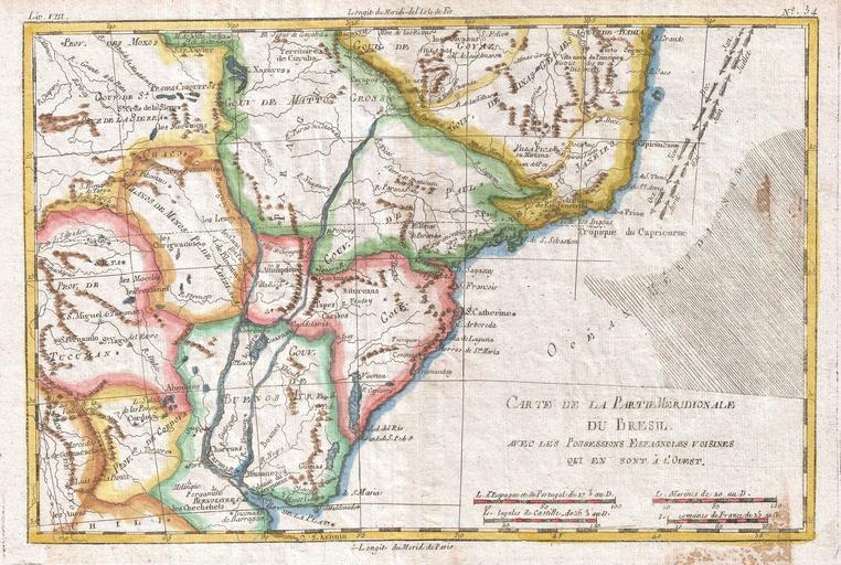
| Keywords: 1780 Raynal and Bonne Map of Southern Brazil, Northern Argentina, Uruguay and Paraguay - Geographicus - Bresil-bonne-1780.jpg A fine example of Rigobert Bonne and G Raynal ôs 1780 map of southern Brazil Uruguay and northern Argentina including Rio de Janeiro Montevideo and Buenos Aires This map generally corresponds to modern day Minas Gerais Sao Paulo Parana Santa Catarina Rio Grande du Sol Uruguay Buenos Aires Motto Grosso and Paraguay Offers surprising detail of the interior considering that this region was largely unexplored when this map was drawn Of course much of this speculative including the Laguna de Xarayes a mytical lake at the northern terminus of the Paraguay River that was associated with the Earthly Paradise by early explores Xarayes named after a local indigenous group was most likely a misinterpretation of the Pantanal flood plain during the rainy season Drawn by R Bonne for G Raynal ôs Atlas de Toutes les Parties Connues du Globe Terrestre Dress√© pour l'Histoire Philosophique et Politique des √Čtablissemens et du Commerce des Europ√©ens dans les Deux Indes 1780 undated Size in 13 9 object history credit line accession number Bresil-bonne-1780 Raynal G <i>Atlas de Toutes les Parties Connues du Globe Terrestre Dress√© pour l'Histoire Philosophique et Politique des √Čtablissemens et du Commerce des Europ√©ens dans les Deux Indes</i> 1780 Geographicus-source PD-old-100 1780 maps Old maps of Argentina Old maps of Bolivia Old maps of Brazil Old maps of Paraguay Old maps of Uruguay Maps in French | ||||