MAKE A MEME
View Large Image

| View Original: | 1760_Bellin_Map_of_Bali,_Indonesia_-_Geographicus_-_Bali-bellin-1760.jpg (2668x2097) | |||
| Download: | Original | Medium | Small | Thumb |
| Courtesy of: | commons.wikimedia.org | More Like This | ||
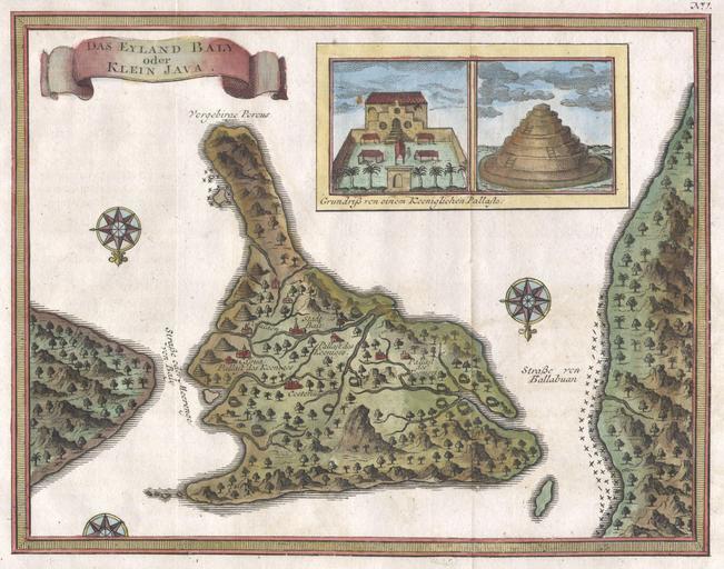
| Keywords: 1760 Bellin Map of Bali, Indonesia - Geographicus - Bali-bellin-1760.jpg An extremely attractive little map of Bali Indonesia by French cartographer J Nicholas Bellin Depicts the island oriented to the south Offers wonderful detail of the inland rivers and villages Upper right quadrant features an inset of the Royal Palace and a Balinese temple Two and a half compass roses decorate the image The island of Java is shown to the right and Lombok to the left The upper left quadrant features a banner style title cartouche Most likely prepared for the Dutch edition of Antoine François PrĂ©vost ™s L'Histoire Generale des Voyages 1760 undated Size in 8 75 7 object history credit line accession number Bali-bellin-1760 Geographicus-source PD-old-100 1760 maps Old maps of Indonesia Maps in German Maps by Jacques-Nicolas Bellin Historical maps of Bali | ||||